The fear of or avoidance of the number 13 is a recognized phobia and has been since 1910 when it was recognized by Isador Coriat in his book Abnormal Psychology. It is estimated that 9 to 10 percent of the US population is at least uneasy about the number 13. Because it is so widespread it even has its own name: Triskaidekaphobia. Fear of Friday the 13th is called Paraskevidekatriaphobia.
Many high rise buildings do not have a thirteenth floor. When I worked in the State National Bank Building in downtown Evanston, Illinois we avoided having to try to lease the thirteenth floor by occupying it ourselves.
From a purely commercial standpoint I can understand if property owners, etc. want to avoid the number "13" but I would really be surprised if they originally had something labeled "13" and then at some point took the "13" away. This is apparently what happened at Rosehill Cemetery in Chicago.
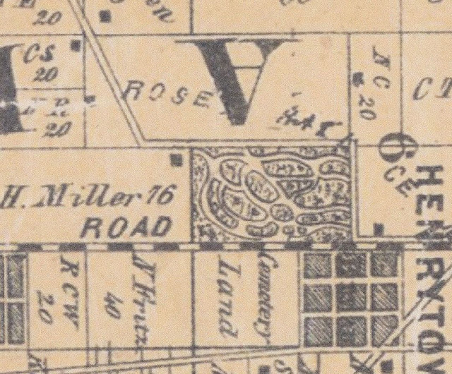
Rosehill Cemetery did not start out at its current size of +/- 350 acres. When it was first dedicated in 1859 it was quite small. Here is part of a map from 1861 showing Rosehill:
Here is a map showing the original size of Rosehill (outlined in black), and the 1883 addition (outlined in yellow):

You can see that the original section was labeled with letters: A,B,C,D,E,F,G,H,I,J,K,L,M,N,O and P. For the 1883 Addition they used numbers: 100, 101, 102, 103, 104, 105, 106, 107 and 108 and then 1, 2, 3, 4, 5 and 6.
Here's Rosehill in 1897:
Not all of the land south of Peterson and west of Ravenswood had been acquired as yet. Rosehill did own land east of Ravenswood along Rosehill Drive but that was ultimately developed with residences, not used as a cemetery.
Here is map of Rosehill from about 1905 that I found in the files of the Evanston Historical Society.
What is on this map, clearly marked, is Section 13, right between Section 9 and Section 16:


